45 Grand Central Terminl New York

EN/Fr

Navigation

SET SAIL FOR NEW HORIZONS OF SAFETY & SECURITY

Selcom Marine provides cutting-edge electronic navigation solutions based on user-friendly innovative technology and global onboard and remote services to offer life-cycle support.

We assist our customers in maximizing machinery, bridging operation efficiency, and improving readiness in operations and safety on board with an accurate overview of the navigation data.

A LEADER IN INTEGRATED AND CUSTOMIZED SOLUTIONS

Our track record that spans decades of experience within the industry allows us to help you identify the best solutions, assess possibilities for integration and monitoring, and ensure each solution is reliable and available.

As independent suppliers, we make sure to supply the finest equipment from world-class manufacturers such as Furuno, Cobham, Jotron, Simrad amongst many others and provide a full suite of equipment ranging from a pilot for your inland vessel to a fully integrated bridge for one of your containerships coupled, and much more to fit all your needs.

CONTACT OUR CUSTOMER SERVICE

Do you have a question about a product or a service? Our customer service team works around the clock to assist you with all your needs. Get in touch with us today!

Featured Products

Gyro Compass

Our Gyro Compasses employ the newest technology and are picked to enable the highest possible accuracy and reliability under the harshest conditions.

VDR/S – VDR

Our voyage data recorders provide accurate historical navigational data in the investigation of maritime incidents.

Marine Radar

We choose for you the right radar to provide clearer and more accurate radar images of the surroundings while increasing reliability.

Echo Sounder

Commonly used for a variety of tasks, including navigation, measuring bottom depth, and detecting schools of fish and plankton.

Autopilot

Self-steering device to maintain the safest course. You can hold your course even when your boat is pitching and rolling in rough water.

Ecdis

With our range of the most reliable EDISs in the world, navigation becomes precise with comprehensive route planning, integrated chart management, radar overlay, and optional conning display.

E-Navigation

YOUR GLOBAL E-NAVIGATION SOLUTIONS PARTNER

Selcom Marine offers you impeccable E-Navigation solutions based on our core values: integrity, safety, innovation, and excellence. We aim to ensure a safe voyage at all times with advanced and easy-to-operate equipment with minimum administration, specifically tailored to all your needs to ensure proactive continuity.

We harness our expertise to provide integrated E-Navigation solutions designed to optimize vessel safety and efficiency and provide a new customer portal where you are able to download the latest chart data and contact the Helpdesk for technical or user support.

Selcom Marine provides more than mere E-Navigation solutions – we also deliver a totally connected E-Navigation ecosystem that helps you empower your operations.

CIRM CYBER RISK CODE

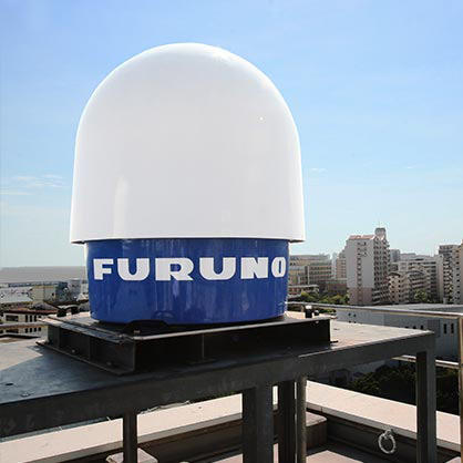
Selcom Marine fully adheres to the CIRM Cyber Risk Code of Practice for marine electronic equipment and service vendors. We adopt a CIRM Cyber Risk Code to power extreme cyber resilience at sea and safeguard shipping from current and future emerging cyber threats and vulnerabilities. The best practices are derived from the marine and other industries and the Code puts forth a set of measures and guiding principles for Vendors to establish their role in the chain of trust for a secure digital maritime environment.

VOYAGE PLANNER

The Voyage Planner is an advanced and novel tool powered by the latest technologies for accurate sea route distance calculation based on detailed and actual past voyages providing instant access to all available electronic charts and nautical publications for more realistic results. With our interactive voyage planner, we help you plan every detail of your sailing trip with utmost accuracy to ensure uncompromised and full safety. The first layer is the electronic navigational chart (ENC) - the digitized version of a nautical chart. The second layer is the Data layer where all important and accurate data is provided. This data revolves around safety and nautical information like Notices to Mariners, weather, and auxiliary information. The third layer is used for voyage planning and allows you to select your starting point, draw your preferred sailing route, and know your exact location through the use of onboarding instruments.

CONTACT OUR CUSTOMER SERVICE

Do you have a question about a product or a service? Our customer service team works around the clock to assist you with all your needs. Get in touch with us today!

DIGITAL TECHNICAL PUBLICATIONS

We give you a comprehensive overview and access to all the new and available technical publications covering important topics from maritime safety and ship handling to insurance and the environment. We ensure that all publications are always accurate and up-to-date to provide you with a reliable source of information.

We have made the process easier than ever for you, and there is no more need for shipping costs and administration related to the maintenance of a paper-based collection as the entire library is instantly uploaded in real-time with the simple click of a button to help you easily find all the information you need.

ELECTRONIC LOGBOOK

Keep your ship compliant by replacing traditional paper logbooks with faster and easier logbook entries ensuring fewer human errors. Our electronic logbook impressively drives your fleet to digitization and help you make faster, smarter decisions. They are fully compliant with IMO, Marpol, SOLAS, and several flag states’ requirements and help you simplify data capture, ameliorate data quality and offer more efficient information exchange.

Featured Products

Electronic Navigational Chart

Always compliant and up to date, our ENC gives vessels, fleets and facilities immediate access to the most trusted charts and publications for every voyage delivered whenever and wherever needed.

Navigator Software

A revolutionary development in the world of maritime cartography and e-navigation, our software allow route planning, AIS features, radar overlay and much more for your cruising or racing.

Vessel Traffic System

EFFECTIVE & INTUITIVE VESSEL TRAFFIC SYSTEM AND COASTAL MONITORING

The main purpose of a Vessel Traffic System (VTS) is to offer active and effective monitoring and crucial navigational information for vessels in busy waterways and critical areas such as harbors, coastal areas, and wind farms. The guidance and management of this traffic is pivotal in line with the increasing maritime traffic at sea or inland waterways.

Selcom Marine offers you powerful and state-of-the-art Vessel Traffic Systems that encompass enormous capabilities aimed at preventing vessel collisions, ramming, and groundings in the harbor, harbor approach, and inland waterway phase of navigation. They also help in expediting ship movements, increasing transportation system efficiency, and improving all-weather operating capability.

Selcom Marine provides an extensive Vessel Traffic Service system with an integrated multisensors network to ensure constant monitoring and empower better tracking capacities for all vessel moments as well as efficient communication in real-time, quick operator response, and cameras used for visual detection and confirmation. Selcom Marine delivers configurations that are well-fitted for numerous different applications like locks in line with local legislation and the IALA recommendations on VTS systems.

TRAFFIC MANAGEMENT

The Vessel Traffic System offers a full-on solution for planning and managing vessel routing in real-time. It integrates with the radar system and other platforms like meteorological/hydrographic systems, voyage planning, and pilotage information systems when it is deemed applicable. The VTS offers the ultimate solution for a more coordinated approach to maritime traffic control, monitoring, and decision support.

Apart from detection, automated procedures can be created in order to act on unauthorized traffic through guard zones and vessel ‘friend or foe’ identification. These guard zones can be automatically communicated to vessels through AIS AtoN information automatically displayed on the chart systems of nearby vessels. The new generation of Vessel Traffic Systems extends the horizons of the efficiency, security, and safety of navigation far beyond the traditional coastal systems.

RADIO COMMUNICATIONS

Selcom Marine supports and supplies radio communication solutions to help operators declare their travel intentions, share their positions, communicate efficiently with vessels, aviation, coastal installations, ships, and offshore installations, and avoid collisions. Our Radio Communications solutions work seamlessly to ensure safety, security, and comfort at sea at all times. We also cover large areas with a radio system that consists of various radio stations, all operated from a single remote location, offering geographical filtering to keep the operator focused and ensure safe navigation. Demonstrating unprecedented stability and high-capacity communication in real-time, the intuitive and uniform user interface enables simple and practical operations.

Featured Products

Thermal Imaging Cameras

Cameras range from stabilized multi-sensors to thermal imaging cameras, to different monitoring distances to infrared cameras that are applicable for the use by authorities, marine surveillance, marine rescue, oil spill response and vessel traffic management systems.

Large-Scale Surveillance Radar System

Designed to effectively manage vessel traffic in ports, harbors, and coastal areas. It collects data and provides tools for a coordinated, global approach to maritime traffic control, monitoring and decision support.

Meteorological Monitoring Radars

High resolution weather radars have proven essential for forecasting weather disturbances, fire and volcanic ash detection. Their objective is to provide safety to vessels and ports by presenting highly detailed information of potential meteorological events.

Coastal Monitoring Software

Coastal surveillance solutions that incorporate radars with coastal monitoring software and systems.